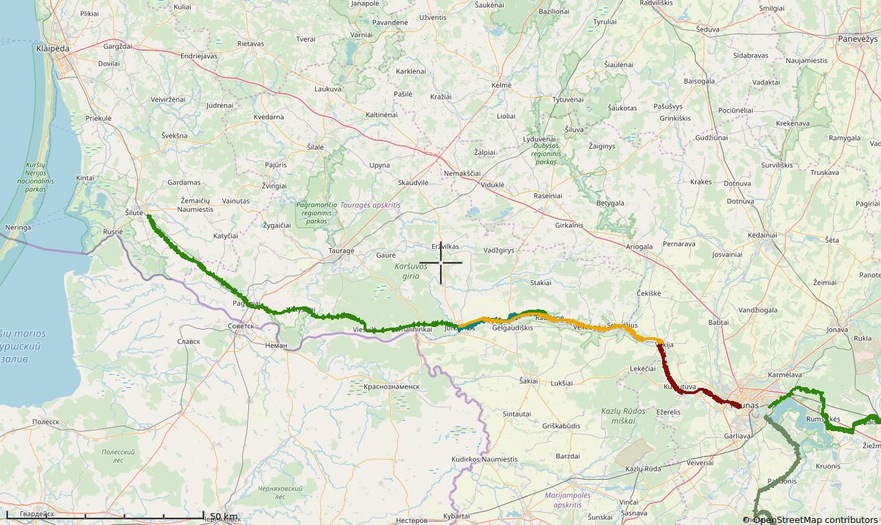
[:en]Kaunas-Šilūtė[:de]Kaunas-Šilūtė[:]

LT2, Part 5a Kaunas-Pavilkys / Vilkija (South bank of Nieman river)

Maps from the  “Nieman cycle trail” (2004)   Map (2020) [sgpx gpx=”/wp-content/blogs.dir/3/files/gpx/LT2_6a_Kaunas_Pavilkys.gpx”] Route: Kaunas center –6,5– Marvelė –9,5– Kačerginė –4– Zapyškis – 13,5 – Mikytai –1,5– ferry through Nemunas – Vilkija Kačerginė It started to become famous as a resting place in the beginning of the 20 cent. In the summer of 1906, Jonas Biliūnas

LT2, Part 5a Kaunas-Pavilkys / Vilkija (South bank of Nieman river) Read More »
LT2, Part 6a (main route) Vilkija-Jurbarkas

[sgpx gpx=”/wp-content/blogs.dir/3/files/gpx/LT2_7_Vilkija-Jurbarkas_with_new_bike_path.gpx”] Maps from the “Nieman cycle guide” book (2004)   Zapyškis – Šilinė Route Vilkija –12,5– Seredžius –10– Veliuona –11– Raudonė –11,5- Šilinė  –4–Skirsnemunė –9– Jurbarkas Vilkija In the historical sources, Vilkija is mentioned from 1430 09 22. In 1450, the documents of Gdansk’s traders mention Vilkija’s customhouse, the first in Lithuania, by the

LT2, Part 6a (main route) Vilkija-Jurbarkas Read More »

LT2, Teil 6b (Alternative Route): Pavilkys-Jurbarkas (Südufer) 4,5,6

LT2, Teil 6b (Alternative Route): Pavilkys-Jurbarkas (Südufer) 4,5,6 Read More »

LT2, Part 7. Jurbarkas-Šilūtė

Maps from the “Nieman Cycle Guide” (2004)   Route: Jurbarkas –13– Smalininkai –13– Viešvilė –20– Vilkyškiai –6,5– Lumpėnai –4– Bitėnai –1,5– Rambynas hill. –6,5– Mikytai –4– Pagėgiai –9– Rukai –6,5– Usėnai – 12 – Leitgiriai –4– Kantariškės –15– Pagryniai –3– Šilutė New Map: [sgpx gpx=”/wp-content/blogs.dir/3/files/gpx/LT2_8_1_Jurbarkas_Smalininkai_Rambynas_Silute.gpx”] Jurbarkas Jurbarkas is situated on the right Nemunas’ shore, the

LT2, Part 7. Jurbarkas-Šilūtė Read More »

Scroll to Top