 |
Welcome to Sl?tere!
There are 9 new routes for hiking, skiing, cycling, canoeing, and self-drive and nature sightseeing tours developed in Sl?tere National Park. Just print out the route description with attached map and enjoy your trip! Every route description includes: short description of points of interest, information about available tourism services and accommodations, contact information for bike/boat rentals, tourism information boards etc. Nature sightseeing, animal and bird watching tours is suggested in a company with experienced guide.
If you plan to stay in the territory of the National Park more than one day choose one of offered accommodations and call Lauku celotajs for booking.
There is more practical information available also in our travel guides and tour maps. |
 |
|
|
 |
Hiking
|
|
|
 |
 |
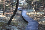
The Kolkasrags circle
|
This route is meant for hikers who want a bit more than just a stroll from the car park to a popular destination. This is an interesting way to look at the Kolkarsags promontory (the Cape of Kolka) from different viewpoints.
| Season |
Year-round |
| Length |
~3 km |
| Time |
1-2 h |
| Difficulty |
Easy |
| Road cover |
Forest roads, beach, paved and gravel roads |
| Beginning |
Kolkasrags car park |
| End |
Kolkasrags car park |
| Route |
Kolkasrags visitor centre – Kolkasrags – the Kolkasrags Pine trail – firing range – Kolkasrags visitor centre |
| Alternatives |
You can go in the opposite direction on the route. You can also continue on to the Uši campsite, walking along the beach or one of the forest roads (another 3 km). |
| Distance from R?ga |
150 km |
| Logistics |
A circular route which ends where it began. |
| Note |
Bring this information sheet with you when you go on the route. During the spring and autumn, dress warmly, and bring binoculars for bird watching with you. |
Route description/ map
|
 |
|
 |
 |
|
 |
 |
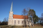
Learn about Mazirbe
|
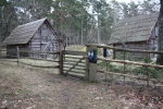
This is a route for active hikers, and it covers Mazirbe and its surroundings. Here you will find information about the Liv people and their culture. The Liv nation has lived on the shores of the sea in this region for many centuries.
| Season |
Year-round |
| Length |
7-10 km |
| Time |
~ 2 – 3 h |
| Difficulty |
Easy |
| Road cover |
Mostly paved and gravel roads |
| Beginning |
Mazirbe church |
| End |
Mazirbe church |
| Route |
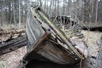
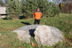
Mazirbe church – M?rakme?i – Liv People’s Hall – Boat Cemetery – Baltic Sea shoreline – Mazirbe church |
| Markings |
Some parts of the route will be marked by colours on the trees |
| Alternatives |
You can start at the Liv People’s Hall. You can follow the marked bike route Kolka-Mazirbe-S?krags, or you can follow the seashore to Kolka (~20 km), spending the night in one of the seashore villages. |
| Distance from R?ga |
170 km |
| Logistics |
A circular route which ends where it began. |
| Note |
Bring this information sheet with you when you go on the route. |
Route description/ map
|
 |
|
 |
 |
 |
|
 |
 |
Along the seashore and coast
|
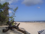
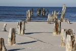
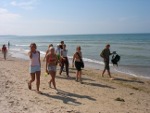
The territory of the Sl?tere National Park has a sandy beach that is around 40 kilometres long and is appropriate for short hikes or ones that take several days. There are no insurmountable obstacles for people on foot between Melnsils and S?krags. Route descriptions show the distance in kilometres between major populated areas. This will allow you to plan a route that is in line with your abilities and your interests.
| Season |
Year-round |
| Difficulty |
Easy |
| Route |
Here are a few hiking routes:
• Mazirbe-Vaide
• Vaide-Kolkasrags
• S?krags-Kolkasrags (two days, spending the night at Košrags or Vaide)
• Melnsils-Kolka |
| Logistics |
Plan a circular route which leads back to the point of origin. |
| Note |
Bring this information sheet with you when you go on the route. |
Route description/ map
|
 |
|
 |
 |
 |
|
 |
Cycling
|
|
|
 |
 |
Sl?tere circle
|
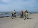
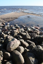
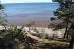
This route is appropriate for active tourists who are interested in coastal landscapes and the culture of the Liv people. The old forest road passes through five Liv villages: Mazirbe, Košrags, Pitrags, Saunags and Vaide. Some trace of the old days and fishermen lifestyle is still found here. From Košrags the route takes the ”Apakšce?š” – a lonely old forest road between Košrags and D?mele passsing the Bažu bog. After D?mele the route returns to Kolka.
| Season |
May-September |
| Length |
~50 km – one day or two days, spending the night at tourism facilities |
| Time |
~1-2 days |
| Type of bicycle |
Mountain bike |
| Difficulty |
Medium |
| Road cover |
Forest roads along approximately 2/3 of the way, paved roads elsewhere |
| Beginning |
Kolka (car park or other location) |
| End |
Kolka (car park or other location) |
| Route |
Kolka-Vaide-Saunags-Pitrags-Košrags-D?mele-Ezermuiža-Melnsils-Kolka |
| Markings |
The Kolka – Košrags part is marked by yelow colour on trees |
| Alternatives |
You can ride the route in any direction, or start at Košrags or Melnsils, because it is a circular route. |
| Distance from R?ga |
150 km |
| Logistics |
A circular route which ends where it started |
| Note |
The forest roads, particularly between Košrags and D?mele, can be a mess, particularly after spring rains. There are a few sandy areas which will be more difficult to traverse. |
Route description/ map
|
 |
|
 |
 |
 |
|
 |
 |
Liv villages
|
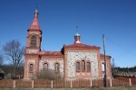
This route is appropriate for active tourists who are interested in coastal landscapes and the culture of the Liv people. The old forest road passes through five Liv villages: Mazirbe, Košrags, Pitrags, Saunags and Vaide. Some trace of the old days and fishermen lifestyle is still found here. Returning by the Ventspils – Kolka road.
| Season |
April-October |
| Length |
~28 km, doable in one day |
| Time |
~5 h if you stop and look at the villages |
| Type of bicycle |
Mountain bike |
| Difficulty |
Medium |
| Road cover |
Approximately half of the route is paved, while roads in the forest are gravelled in some places and paved in others. |
| Beginning |
Mazirbe, Liv People’s Hall |
| End |
Mazirbe, Liv People’s Hall |
| Route |
Mazirbe-Košrags-Pitrags-Saunags-Vaide, then the P 124 road back to Mazirbe |
| Markings |
Between Mazirbe and Vaide, the route is marked with yelow signs on trees. |
| Alternatives |
You can ride the route in the opposite direction or continue along the Kolka-Mazirbe-S?krags bike route that has been established by the Sl?tere National Park (passing through the forest back to Kolka, this will add 11 km to your route). Because this is a circular route, it can be started or finished anywhere. |
| Distance from R?ga |
170 km |
| Logistics |
A circular route which returns to where it began |
| Note |
The forest roads between the Liv villages can be in poor shape – they’re sandy and can have big puddles when it rains, and tree roots on the surface. |
Route description/ map
|
 |
|


