
[3] Route No. 3
http://www.gpsies.com/map.do?fileId=paozkoemuqpvjszu
Lakes in the North East
Route description:
http://velovilnius.lt/wp-content/uploads/2016/06/dviraciu_turizmas_EN_route3-antaviliai.pdf
[4] To Kairėnai Botanical Gardens and the Lakes on the North East
Old description
NO_Kairėnai_Lake Tapėliai km EN (g. = gatvė = Street)
28.1 km all together 5 Centre (road on the left bank of Neris river)
map: http://www.bicycle.lt/repository/Dvir/vilnius/centre_NO_Katedra_Sauletekis.png
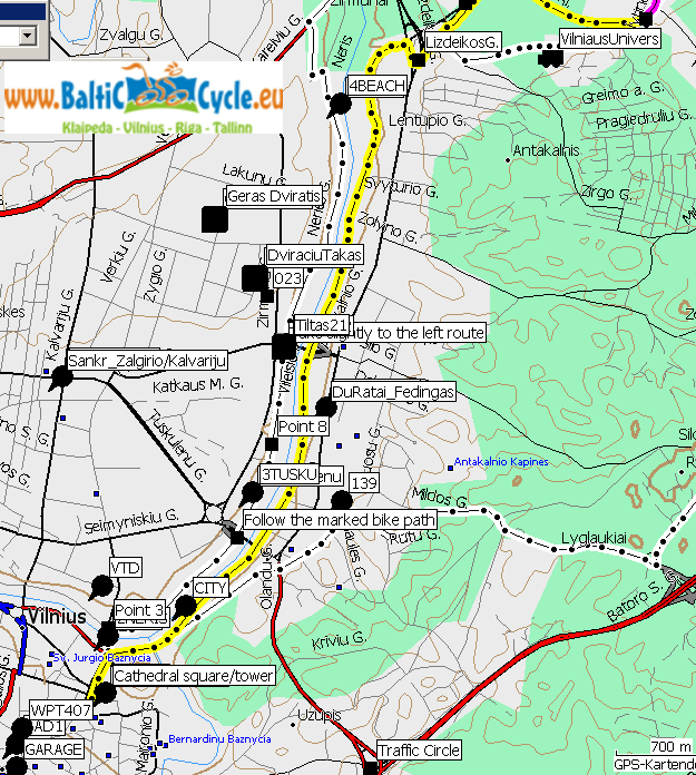
Start at the cathedral take the bike path around the National Museum or via Sereikiškių Park cross the bridge over river Vilnelė to the traffic light cross the road at the traffic light and go down to the river, ride always straight to the quarter of Antakalnis
3.5 NO m (1) / Kairėnai
 map: http://www.bicycle.lt/repository/Dvir/vilnius/NO_M_Kairenai_Valakampiai.png
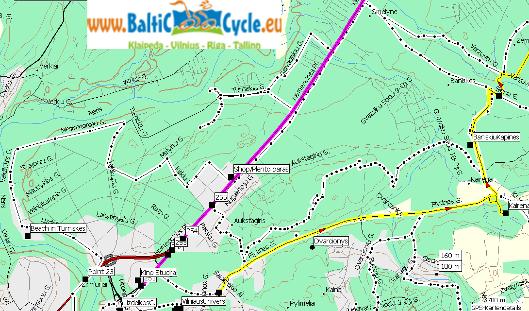
„At the end“ turn right (left hand a sports place) and go up at the Clinics up to the Traffic roundabout of Antakalnis Cross Antakalnis street at the Traffic light turn right (away from the main road) and follow the pedestrian/cyclist path to the buildings of the university (VilniusU and Technical U turn left towards Plytinės str., turn right into the stree Follow the road (on the pavement) to the Botanical Gardens in Kairėnai. Partly there is a bicycle path!
7 NO n (2) / Kairėnai – Lake Tapeliai (Beach!)
 map:http://www.bicycle.lt/repository/Dvir/vilnius/NO_N_Tapeliu_Ezeras.png
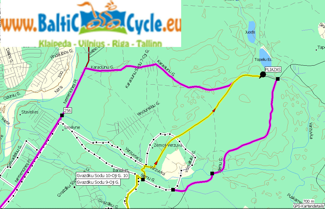
turn left on the paved road Pass Baniškės cemetary At Sienai road go straight (asphalt: more traffic but better road surface) OR turn right (Forest path, less traffic but worse road surface). P.S.: It’s possible to go ahead to Šilo lake…
6 NO m (3) / Lake Tapeliai– Nemenčinės plentas – Valakampiai  map: http://www.bicycle.lt/repository/Dvir/vilnius/NO_M_Kairenai_Valakampiai.png
Use the paved road Karaciunų g. In order to return to Nemenčinės plentas Road turn left and follow the bicycle path along Nemenčinės plentas down to the “Plentas Pub”, there cross the road, turn right (away from Nemečinės plentas) Easier way: Get into the Svajonių g. OR: Follow the Ežerėlių g. To it’s end, turn left (Galgalių g.), turn right (Kiškių g.), turn left (Melynių g.) Ride to Neris river, then parallel to the river, follow the road to the second and the first beach 6.6 Centre: Valampiai- bicycle path “EuroVelo” (Right side of Neris river) to Mindaugas bridge
 map: http://www.bicycle.lt/repository/Dvir/vilnius/centre_NO_Katedra_Sauletekis.png
ride up the Lizdeikos street to the bridge (on the right), cross the bridge over Neris river (don’t mix it up with the road bridge…) Ride on the sidewalk of the bridge on it’s right side. At the pedestrian traffic light cross Kareivių street, cycle down to the river, turn right on the bicycle path and follow it to Mindaugas bridge. Cross the bridge and go straight to the Cathedral’s square Alternative: from Valakampiai go straight, pass Antakalnis traffic roundabout, turn right at the gas station, go through the garages (!) until you come back to the sportsground and the bicycle path you came from the centre, and go back like you came in the first part!


